December 30th, 2025
Today was about taking our basic map implementation and “taming” it for the real-world use cases of CommitT. We wanted to move from just “showing a map” to having a fully functional location discovery and geofencing engine.1. Search & Discovery
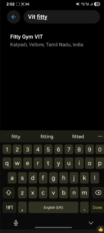
We integrated the Google Places API to allow users to find specific locations without scanning the map manually.- The Search Interface: When a user taps the search icon, they are navigated to a dedicated search screen.
- Concepts Behind the Autocomplete: We implemented a debounced search that fetches predictions from Google Maps. Once a place is selected, we fetch its detailed geometry (latitude and longitude) to update our global state.
2. State Management: Camera vs. Location
One of the trickiest parts was managing where the user is looking versus where the user is committing. We used Zustand to maintain two distinct states:- Camera Target: Where the map is focused. Clicking a search result card updates this target, smoothly sliding the map to the new area.
- Actual Location: The specific point where the commitment circle/geofence is placed.
3. Interaction & Dynamic Feedback
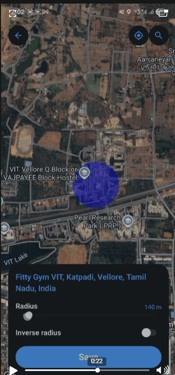
The map now feels like a physical tool thanks to real-time interactions:- Long Press for Placement: Instead of just sticking a circle in the center, users can long-press anywhere on the map to set their commitment location instantly.
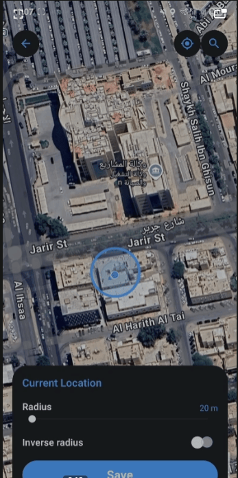
- Native Slider for Radius: We replaced dummy controls with a real native slider. As the user slides, the radius updates in the central store, and the map’s circle expands or shrinks in real-time.
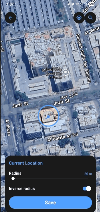
4. The Inverse Geofence (The “Stay In” vs “Stay Out” Logic)
This is a core feature for discipline. Sometimes you need to stay within a area (like the Gym), but sometimes you need to stay out of an area (like a bar or a friend’s house). We implemented an “Inverse” toggle:- Inward Fill: A standard translucent blue circle indicating your allowed zone.
- Outward Fill (Inverse): We used a complex polygon calculation (wrapping the entire globe and cutting a circle out of it) to shade everything outside the target zone. This visually reinforces that the rest of the world is “off-limits” for the duration of the commitment.